Paper Maps, Gas Station Strangers, and Absolute Confidence in the Wrong Direction — Road Trips Before GPS
Paper Maps, Gas Station Strangers, and Absolute Confidence in the Wrong Direction — Road Trips Before GPS
Somewhere in America right now, a driver is arguing with their GPS. The app wants them to take the highway. They want the back road. A small digital negotiation is underway.
This is a problem their parents never had, because their parents' navigation system was a folded paper rectangle shoved in the glove compartment, last updated in 1987, with half of Route 66 obscured by a coffee stain.
If you grew up in the pre-smartphone era, the words "we'll figure it out when we get there" were not a casual expression. They were a genuine travel strategy.
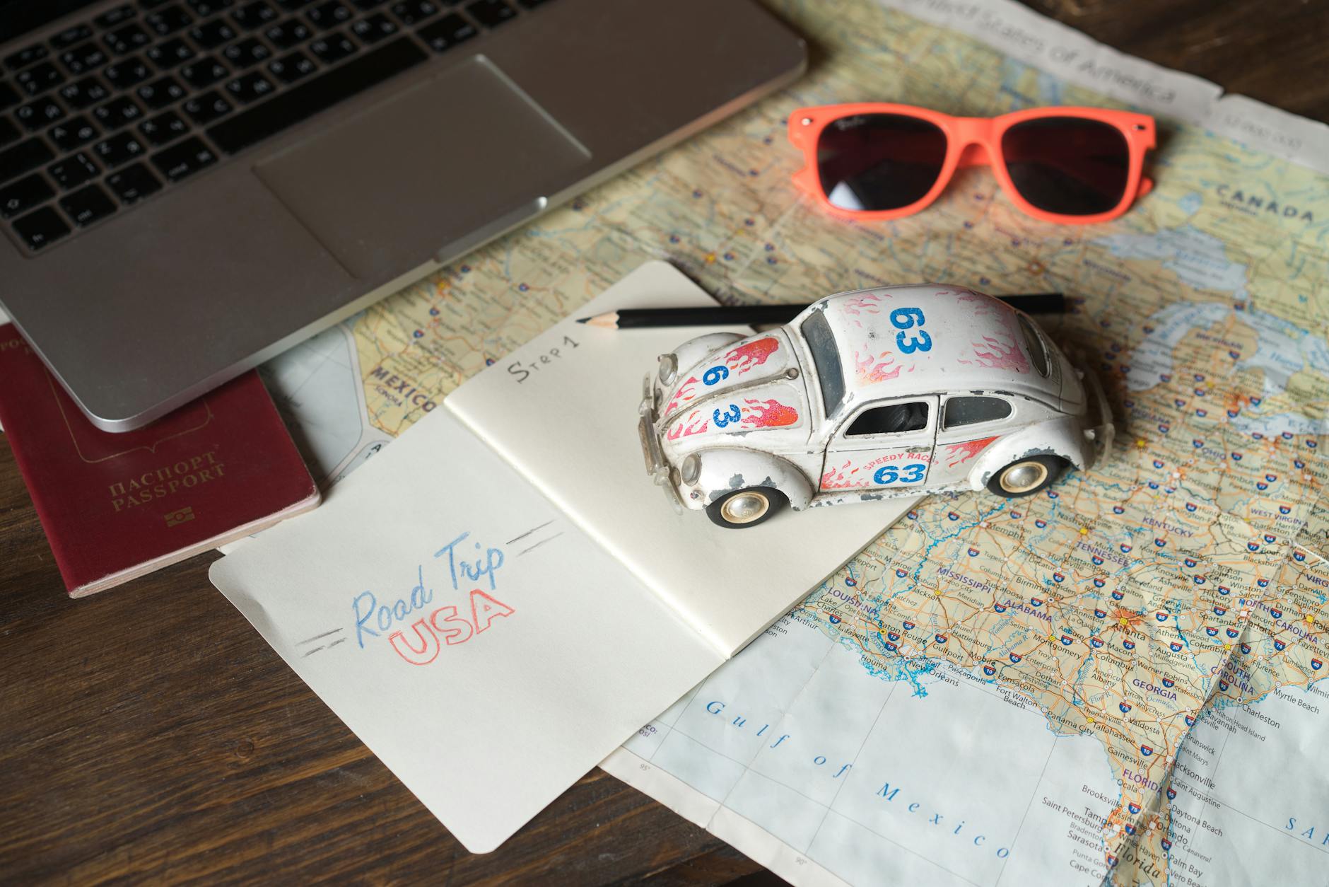
The Paper Map Was a Lifestyle
Let's talk about the gas station map, because it deserves its moment. For most of the twentieth century, these things were free — handed out at filling stations, available at rest stops, tucked into welcome center brochures at state lines. Rand McNally and AAA printed millions of them annually. Families accumulated them the way people today accumulate charging cables: always slightly more than needed, never quite the right one.
Using a paper map was a skill. Not a complicated one, but a real one. You had to orient the map to your direction of travel, identify landmarks, estimate distances, and mentally track your progress across a page that was simultaneously too large to hold comfortably and too small to show the level of detail you actually needed. Refold it incorrectly once and you were essentially holding an origami accident for the rest of the trip.
Kids in the backseat were frequently deputized as co-navigators, which led to one of the most reliable road trip experiences in American family history: the child confidently announcing a turn approximately forty-five seconds after you'd already passed it.
Enter the AAA TripTik — The Original Turn-by-Turn
For drivers who wanted something more structured, AAA offered a product called the TripTik — a custom spiral-bound booklet of strip maps showing your specific route, segment by segment, with handwritten notes from AAA staff about construction, detours, or points of interest along the way.
This was genuinely impressive for its era. You'd walk into an AAA office, tell them your start point and destination, and a real human being would assemble a personalized navigation booklet for your trip. It was analog route planning at a surprisingly sophisticated level.
The TripTik still exists, technically — AAA now offers a digital version. But the original physical booklet, assembled by hand at a local branch? That era is long gone, and it took a particular kind of road trip intimacy with it.
Asking Directions Was a Social Contract
When the map failed — and the map always eventually failed — you asked someone. This was simply understood. You pulled into a gas station, a diner, or a random parking lot, and you asked the nearest human being for directions.
This interaction was its own subculture. Some people were phenomenally helpful, drawing little maps on napkins, walking you outside to point down the road, giving you landmarks so specific they could only have lived in that town for forty years. "Go past the old Miller farm — the one with the red silo, not the white one — and turn left at the Methodist church."
Other people were confidently, spectacularly wrong. They'd give you directions with total authority, and you'd follow them for twenty miles before the road turned to gravel and ended at a field. No malice intended. Just the eternal human problem of not knowing what you don't know.
Gas station attendants — actual attendants, who came out and pumped your gas, which was its own vanishing world — were generally reliable. They saw every lost traveler in the county. They knew the roads.
Getting Lost Was Just Part of the Deal
Here's something younger drivers might find genuinely difficult to process: before GPS, getting lost wasn't a failure. It was an expected component of travel, especially in unfamiliar territory. People budgeted time for it. Road trips had loose itineraries specifically because everyone understood that wrong turns happened, that highways merged in confusing ways, that the exit you needed was occasionally not signed until you were already past it.
This produced a different psychological relationship with travel. You weren't following a script. You were navigating, in the older sense of the word — making decisions in real time with incomplete information, adjusting, backtracking, occasionally discovering something interesting precisely because you weren't where you were supposed to be.
There's a reason so many road trip stories from the pre-GPS era involve stumbling onto a great roadside diner, a scenic overlook nobody told them about, or a small town that turned into an unexpected overnight stop. When you're not being routed efficiently from point A to point B, the space between those points gets a lot more interesting.
What the Numbers Say About the End of an Era
Rand McNally sold over 300 million road maps annually at the peak of the print era. By 2010, with smartphone navigation already reshaping habits, that number had collapsed. Dedicated GPS device sales peaked around 2008 and fell sharply within just a few years as Google Maps and Apple Maps became standard phone features. Today, printed road map sales are a fraction of what they once were — a niche product for collectors, preppers, and the occasionally very offline camper.
The shift was fast. Within about a decade, a navigation system that had been essentially unchanged for a century was replaced almost entirely by a piece of software on a device that also plays your music and texts your mom.
Something Small Got Left on the Side of the Road
Nobody seriously wants to go back. Turn-by-turn navigation is genuinely better. It's faster, more accurate, updated in real time, and it has probably prevented millions of arguments between couples about whether that was supposed to be exit 47 or exit 74.
But there was something in the old way of getting around that's worth at least a moment of recognition. The map spread across the hood of the car at a rest stop. The gas station attendant with the napkin directions. The wrong turn that became the best part of the trip.
Getting lost used to be an adventure. Now it's mostly just a reason to recalibrate.